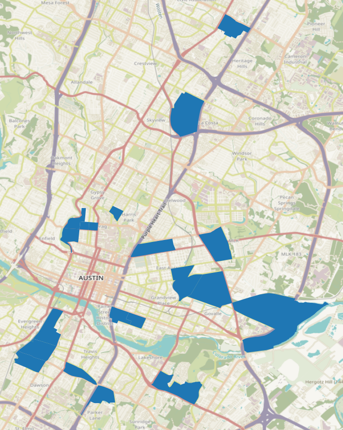
20 locations where we should expand MetroBike
Using data to estimate good places for new MetroBike kiosk locations.
Disclaimer: This is a personal project of mine. Not an official project of CapMetro or the City of Austin
Austin’s docked bike share system received $11.3 million from TxDOT last year to help expand. I’m a big fan of the service, but like a lot of Austinites I no longer live near any of the kiosks. So I wanted to see what locations I could suggest using data.
Methodology
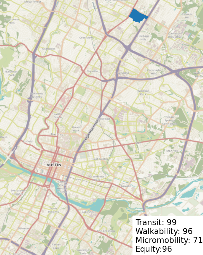
I ranked every census block group in the Austin region by four measures: transit, walkability, micromobility demand, and equity. Each census block group was ranked on these four measures and a better ranking transferred a higher score for the block group. I weighted the four measures as such: 35% for transit, 20% for walkability, 35% for micromobility, and 10% for equity.
If you want to play with these weights and test different results, try my tool I created for this here.
The code I wrote for this project is located in this repo.
Data Sources:
Walkability
The Environmental Protection Agency (EPA) provides walkability estimates for census block groups
Transit Access
The EPA also estimates transit access in meters by census block groups
Micromobility Trips
The number of micromobility trips (dockless scooters/bicycles) started or ended in a census tract. Data is provided by the City of Austin
Equity
A vulnerability index based on several census tract-level fields. Provided by the City of Austin
Top 20 expansion locations
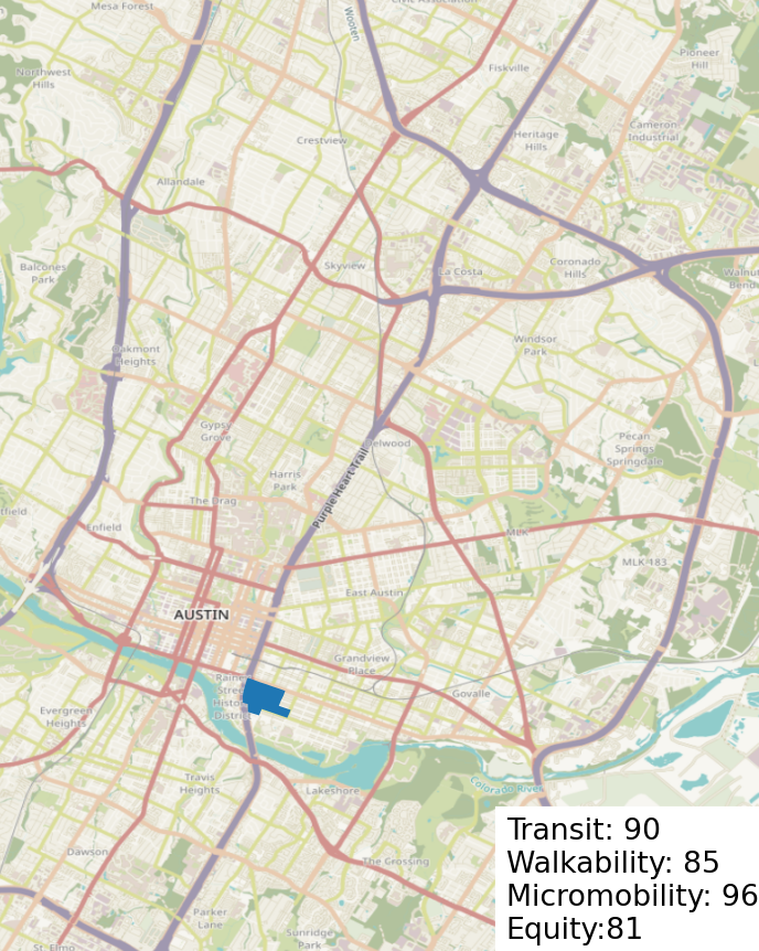
1. South Congress & Oltorf
Why it makes sense:
- High frequency transit (route 801/1)
- Close by existing kiosk @ Congress/Mary
- H-E-B
Two parks:
- Blunn Creek Nature Preserve
- Big Stacy Neighborhood Park
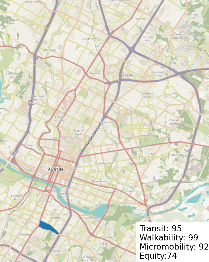
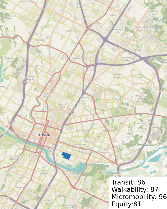
2. Oltorf & Parker
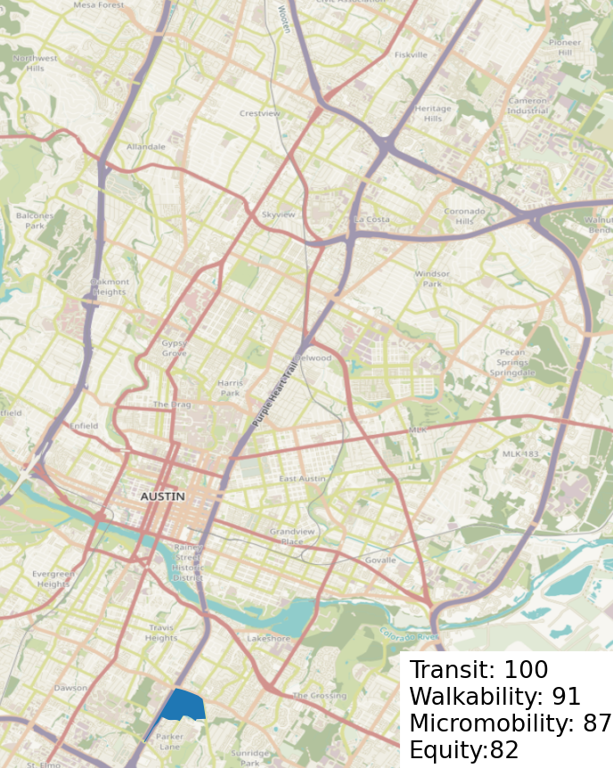
Why it makes sense:
- High frequency transit (route 7)
- Linder Elementary School
Parks:
- Mabel Davis District Park
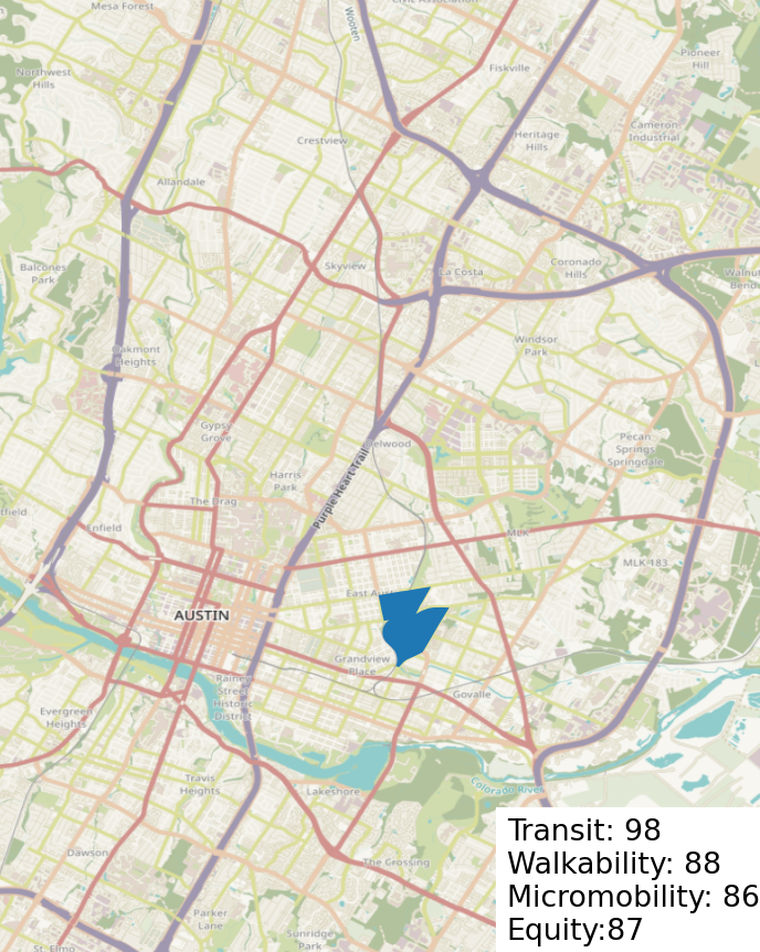
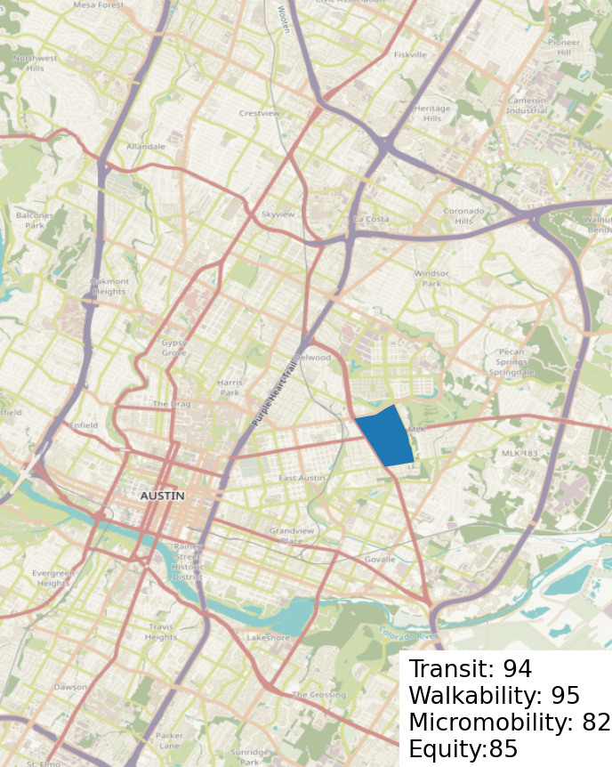
3. Bolm District
Why it makes sense:
- Near to eastside bus plaza kiosk
- Transit service (route 350)
- Eastside Memorial HS
Parks:
- Govalle Neighborhood Park
- Bolm District Park
- Walnut Creek Trail
- East Boggy Creek Greenbelt
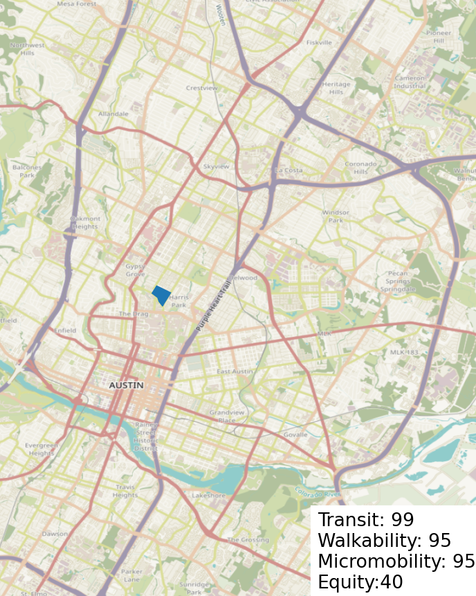
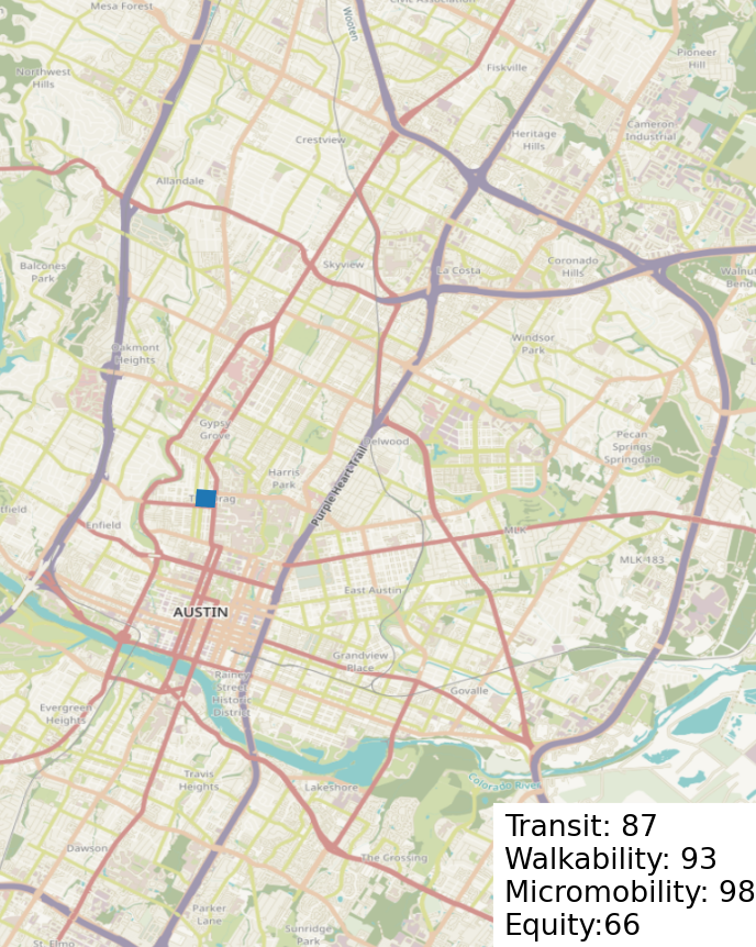
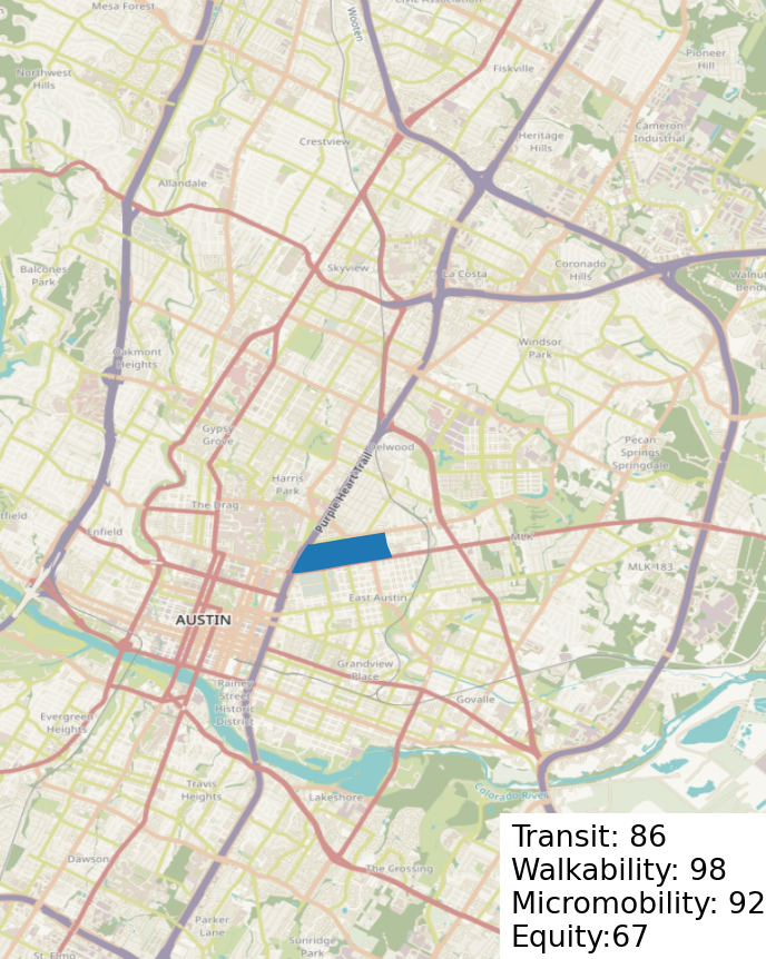
4. Rio Grande @ 24th + 5. Longview
I combined 4 and 5 as they are neighbors to each other.
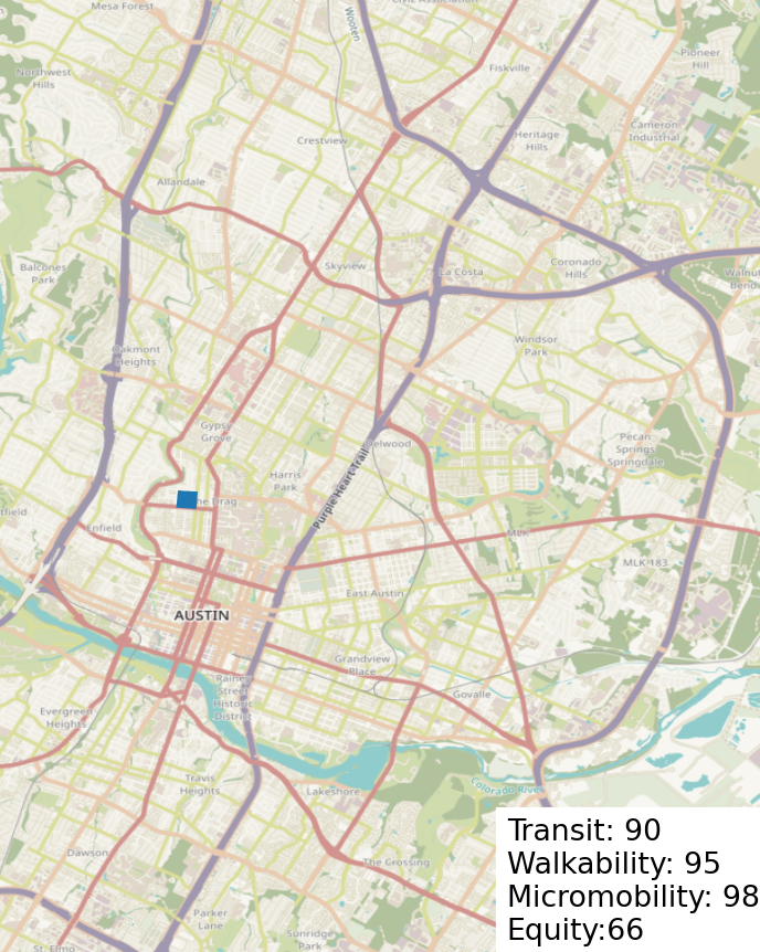
Why it makes sense:
- Existing kiosks north and south
- Frequent transit service on Guadalupe and Lamar
- High existing demand
- Dense walkable area near UT
- Existing two-way protected bike lane
Parks:
- Pease Park
- Shoal Creek Greenbelt
6. Rosewood + 8. Govalle
I combined 6 and 8 as they are neighbors to each other.
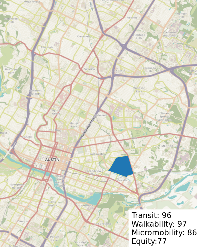
Why it makes sense:
- Eastside early college HS
- ACC Eastview
- Frequent transit service (route: 300)
Parks:
- Rosewood Neighborhood Park
- Boggy Creek Greenbelt
- Parque Zaragoza Neighborhood Park
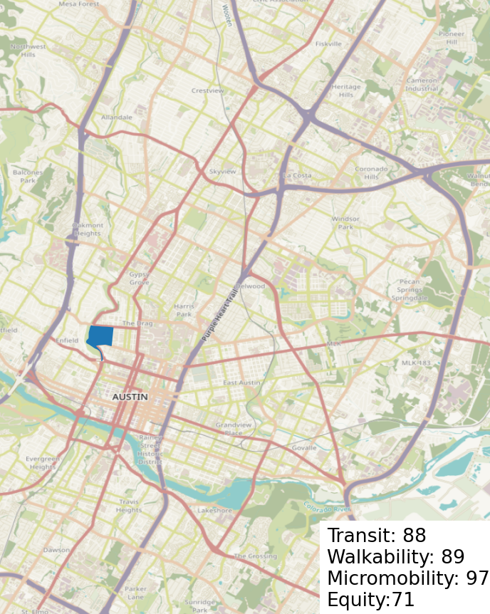
7. Speedway & 31st
Why it makes sense:
- High existing demand near UT
- Frequent transit service (route: 7, 656)
Parks:
- Adams-Hemphill Neighborhood Park
9, 11, 14. South Fifth
I combined 9, 11, and 14 as they are neighbors.
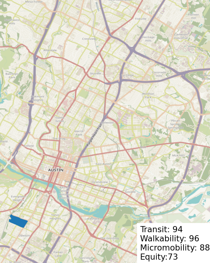
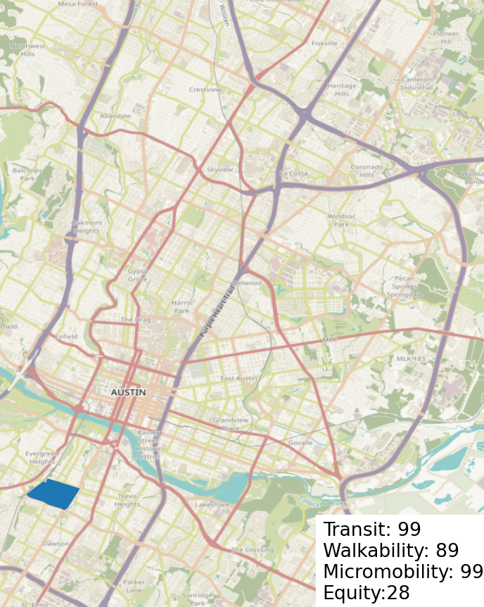
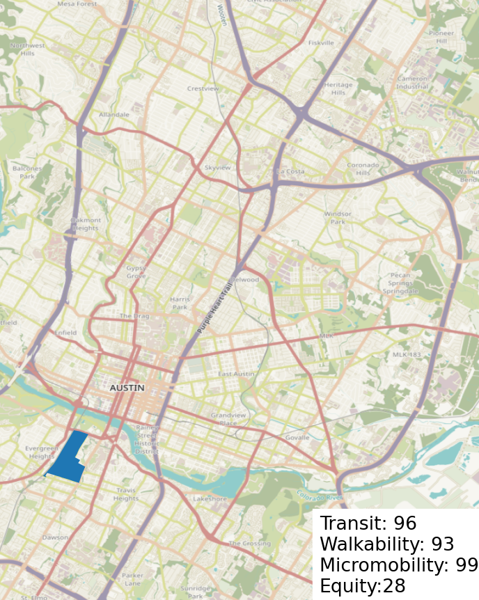
Why it makes sense:
- High existing demand
- Frequent Transit service (route: 105, 10)
Parks:
- South Austin Neighborhood Park
- Auditorium shores
- Nicholas Dawson Neighborhood Park
10 and 17. Holly
I combined 10 and 17 as they are neighbors.
Why it makes sense:
- High existing demand near downtown
- Transit service (322)
Parks:
- Festival Beach
- Town Lake
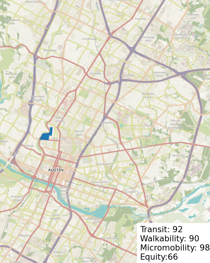
12 and 13. More of West Campus
I combined 10 and 17 as they are neighbors.
Why it makes sense:
- High existing demand
- High frequency transit on Guadalupe and Lamar
- Dense, walkable area near UT
Parks:
- Pease Park
- Shoal Creek Greenbelt
15. East MLK
Why it makes sense:
- Transit routes (350, 18)
Parks:
- J.J. Seabrook Greenbelt
16. Highland
Why it makes sense:
- Transit hub (red line, 7, 337)
- Walkable area
- ACC Highland
18. MLK-Manor
Why it makes sense:
- Transit service (Red line, 18, 20)
- High walkability and existing demand near UT
Parks:
- Disch-Falk Field (does this count?)
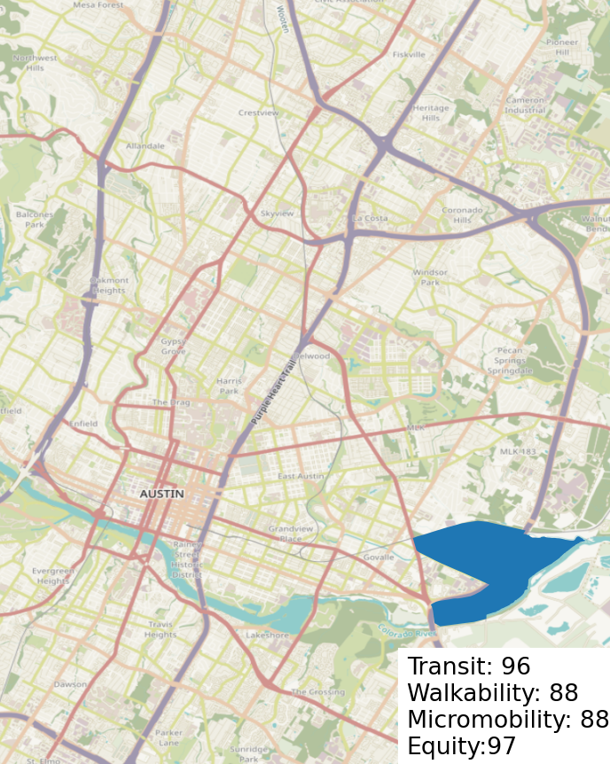
19. Riverside & Pleasant Valley
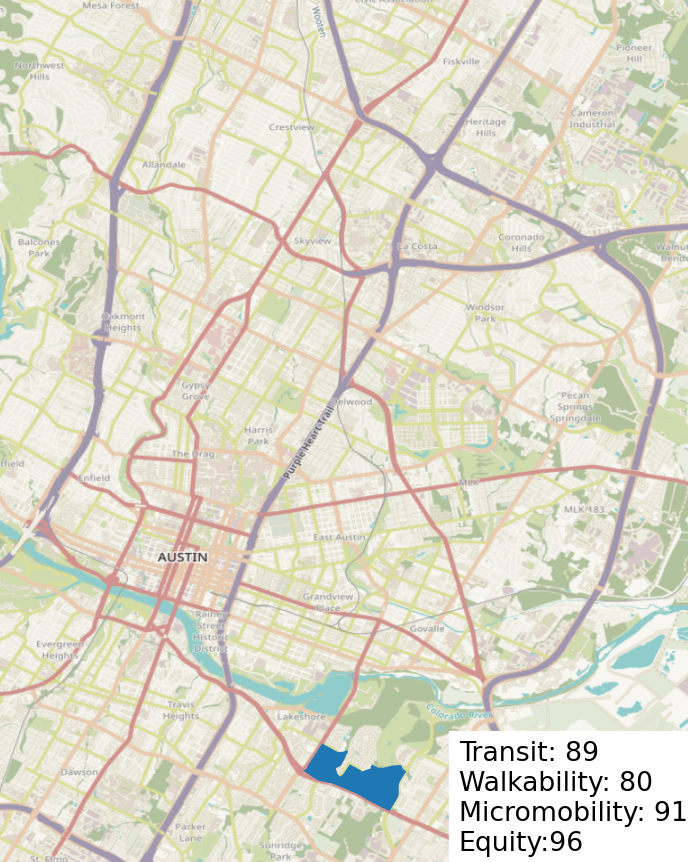
Why it makes sense:
- Transit service (20, 670, 671, 311)
Parks:
- Roy Guerrero Metropolitan Park
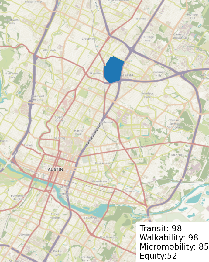
20. Georgian Acres
Why it makes sense:
- Transit service (801/1)
Parks:
- Georgian Acres Neighborhood Park